Owned and operated by the Township of South Glengarry, the Redwood Estates well was constructed in 1995 and is designed for a population of 150, supporting a total of 39 residential lots.
Vulnerability Scoring
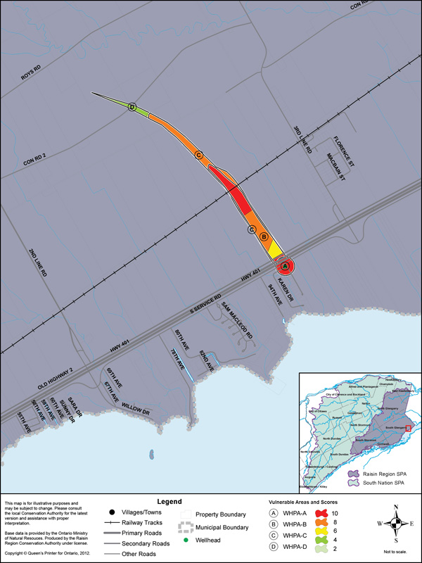
Four Wellhead Protection Areas (WHPAs) have been delineated representing differnt times of travel to the well: WHPA-A, WHPA-B, WHPA-C and WHPA-D (travel times of "immediate", 2 years, 5 years and 25 years respectively). The WHPAs have been scored from 2 to 10. The vulnerability score is a representative measure of the drinking water source's susceptibility to contamination. Higher scores indicate higher vulnerability.
| Vulnerable Area | Land Area by Vulnerability Score (ha) | ||||
|---|---|---|---|---|---|
10 | 8 | 6 | 4 | 2 | |
| WHPA-A | 3.1 | - | - | - | - |
| WHPA-B | 6.7 | 5.2 | 1.9 | - | - |
| WHPA-C | - | 7.8 | 0.8 | - | 0.2 |
| WHPA-D | - | - | 0.1 | 1.9 | 0 |
Source Protection Policies
The following activities if occurring in a vulnerable area near the drinking water source could be a significant drinking water threat*:
- Waste Disposal Sites
- Sewage Works
- Agricultural Activities
- Pesticides
- Salt and Snow
- Fuel
- Chemicals
* Please consult the Source Protection Authority or the Risk Management Official to determine the exact circumstances, and locations where source protection policies apply near this drinking water source.