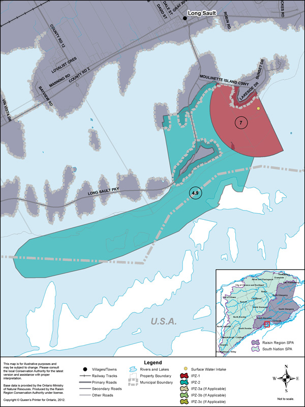
The village of Long Sault municipal water supply and treatment facilities are located on Moulinette Island, south of the village of Long Sault. The intake is in the St. Lawrence River and is located approximately 137 m off shore. Water is drawn from a depth of approximately 8 m. The Long Sault/Ingleside Regional Water Treatment Plant is owned by the Township of South Stormont and is operated by Caneau Water and Sewage Operations Inc. This facility provides treated water to approximately 3500 residents of Long Sault, Ingleside, Wales and Osnabruck Centre.
Vulnerability Scoring
The vulnerability score is a representative measure of the drinking water source's susceptibility to contamination due to the nearby physical landscape (ratio of land to water in the area, land cover, soil type, and hydrological and hydrogeological conditions in the area) and the physical conditions at the intake (depth of the intake, distance from land, past drinking water issues).
Higher values indicate a higher level of concern for contamination. Intake Protection Zones (IPZs) are the areas where policies may apply to protect drinking water sources. IPZ-1 is the zone immediately near the intake. IPZ-2 is an area based on the response time required to react to a reported spill.
| Zone | Vulnerability Score |
|---|---|
| IPZ-1 | 7 |
| IPZ-2 | 4.9 |
Source Protection Policies
The following activities if occurring in a vulnerable area near the drinking water source could be a significant drinking water threat*:
- None
* Please consult the Source Protection Authority or the Risk Management Official to determine the exact circumstances, and locations where source protection policies apply near this drinking water source.