The City of Clarence-Rockland is located about 40 km east of the City of Ottawa. The municipal intake is owned by the city of Clarence-Rockland and is located in the Ottawa River at a depth of 9.1 m and 65 m off shore near the city. In addition to Rockland, this water treatment facility which is run by the Ontario Clean Water Agency also supplies municipal water to Hammond, Bourget, Saint Pascal de Baylon, Cheney and Clarence Creek. This municipal water system serves approximately 13,500 residents.
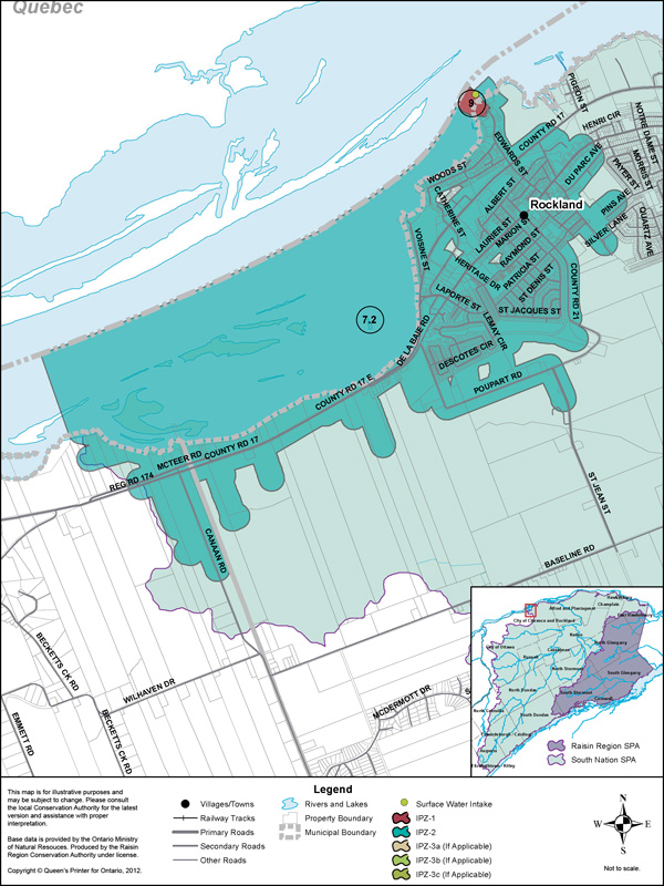
Vulnerability Scoring
The vulnerability score is a representative measure of the drinking water source's susceptibility to contamination due to the nearby physical landscape (ratio of land to water in the area, land cover, soil type, and hydrological and hydrogeological conditions in the area) and the physical conditions at the intake (depth of the intake, distance from land, past drinking water issues).
Higher values indicate a higher level of concern for contamination. Intake Protection Zones (IPZs) are the areas where policies may apply to protect drinking water sources. IPZ-1 is the zone immediately near the intake. IPZ-2 is an area based on the response time required to react to a reported spill.
| Zone | Vulnerability Score |
|---|---|
| IPZ-1 | 9 |
| IPZ-2 | 7.2 |
Source Protection Policies
The following activities if occurring in a vulnerable area near the drinking water source could be a significant drinking water threat*:
- Waste Disposal Sites
- Sewage Works
- Agricultural Activities
- Pesticides
- Chemicals
* Please consult the Source Protection Authority or the Risk Management Official to determine the exact circumstances, and locations where source protection policies apply near this drinking water source.