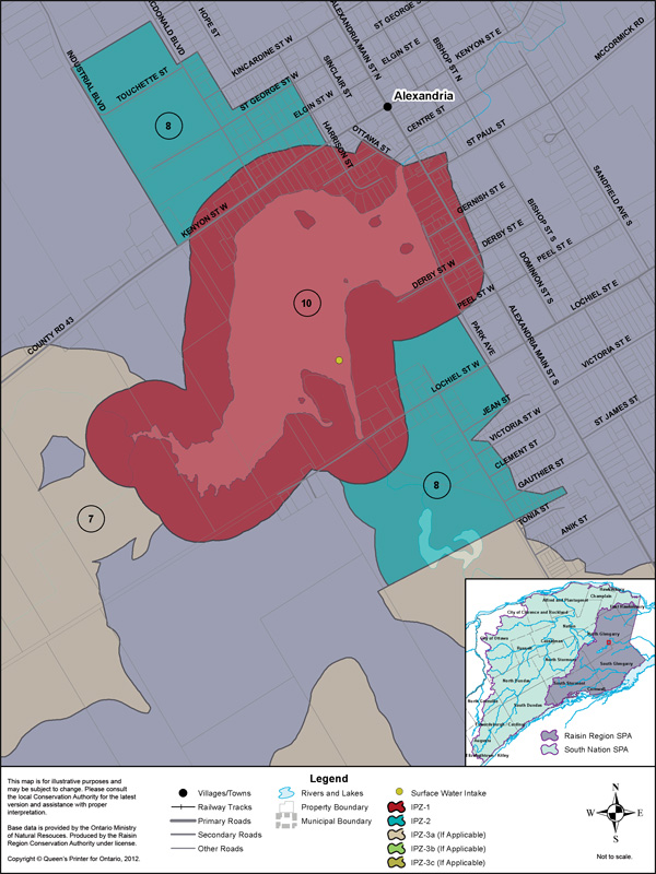
The Town of Alexandria municipal water intake is located within Mill Pond, which is fed by the Garry River system. Mill Pond is the last of three regulated in-land lakes linked by the Garry River. The drinking water system is owned and operated by the Township of North Glengarry. The treatment plant serves a population of approximately 3,600.
Vulnerability Scoring
The vulnerability score is a representative measure of the drinking water source's susceptibility to contamination due to the nearby physical landscape (ratio of land to water in the area, land cover, soil type, and hydrological and hydrogeological conditions in the area) and the physical conditions at the intake (depth of the intake, distance from land, past drinking water issues).
Higher values indicate a higher level of concern for contamination. Intake Protection Zones (IPZs) are the areas where policies may apply to protect drinking water sources. IPZ-1 is the zone immediately near the intake. IPZ-2 is an area based on the response time required to react to a reported spill.
The Alexandria drinking water system has a third area of protection, IPZ-3, which is itself subdivided 3 times, and includes the total area contributing to the intake.
| Zone | Vulnerability Score |
|---|---|
| IPZ-1 | 10 |
| IPZ-2 | 8 |
| IPZ-3a | 7 |
| IPZ-3b | 3 |
| IPZ-3c | 1 |
Source Protection Policies
The following activities if occurring in a vulnerable area near the drinking water source could be a significant drinking water threat*:
- Waste Disposal Sites
- Sewage Works
- Agricultural Activities
- Pesticides
- Salt and Snow
- Fuel
- Chemicals
* Please consult the Source Protection Authority or the Risk Management Official to determine the exact circumstances, and locations where source protection policies apply near this drinking water source.